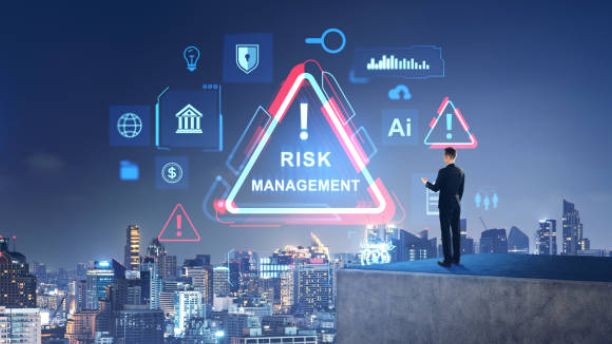
Disaster management involves preparing for, monitoring, responding to, and recovering from natural or human-made emergencies.
An AI-based disaster management system uses intelligent algorithms and digital technologies to analyze information and assist emergency response teams.
The proposed web application provides a centralized platform for monitoring disaster events and managing important information.
The system can receive data from weather APIs, IoT sensors, satellite information sources, geographical databases, and authorized user reports.
Machine learning algorithms can analyze historical and current data to identify patterns associated with potential disaster risks. Based on the available information, the system can generate risk assessments and display relevant alerts.
Main Objectives
Develop an intelligent web-based disaster management application.
Monitor disaster-related information in real time.
Analyze environmental and weather data.
Support AI-based disaster risk assessment.
Display affected locations through interactive maps.
Generate emergency alerts and notifications.
Improve coordination between administrators and response teams.
Maintain historical disaster records for further analysis.
The main objective is to create a centralized information system that supports disaster preparedness and emergency management.
Key Features & Benefits
AI Technologies and Real-Time Disaster Monitoring
Artificial Intelligence and real-time data processing play important roles in modern disaster management systems.
The proposed application combines multiple technologies to collect, analyze, and display disaster-related information.
1. AI-Based Disaster Risk Prediction
Machine learning models can analyze historical disaster records, rainfall measurements, temperature variations, geographical information, and other relevant parameters.
Depending on the available dataset, trained models can estimate disaster risk levels for selected locations.
For example, a flood risk assessment model can consider rainfall intensity, river water levels, soil conditions, and historical flood records.
The system can classify locations into risk categories such as low, medium, and high based on its trained model and configured thresholds.
2. Real-Time Environmental Monitoring
Environmental monitoring is important for identifying changing conditions that may contribute to disasters.
The application can receive data from IoT sensors and external services to monitor:
Rainfall intensity.
Temperature and humidity.
River and water levels.
Wind speed.
Atmospheric pressure.
Soil moisture.
Environmental conditions.
When monitored values exceed configured thresholds, the system can generate alerts for authorized users.
3. Geographic Information System (GIS)
GIS technology helps visualize disaster-related information using geographical maps.
The application can display affected locations, emergency service locations, and risk zones through interactive maps.
Mapping technologies can help administrators understand the geographical distribution of incidents and identify areas requiring attention.
4. Automated Emergency Notifications
The system can generate notifications when a disaster event is reported or a configured risk threshold is exceeded.
Depending on the implementation, alerts can be delivered through:
Email notifications.
SMS gateways.
Web dashboard notifications.
Mobile application alerts.
Push notifications.
5. AI-Based Data Analysis
AI algorithms can process historical and incoming data to identify patterns, classify incidents, and support emergency planning.
Natural Language Processing can also be integrated to classify disaster reports submitted by users and extract relevant information.
Implementation Guide
Key Features of the Proposed System
The proposed AI-based disaster management application provides several functionalities for monitoring and managing emergency situations.
1. Real-Time Disaster Monitoring
The system collects disaster-related information from connected data sources and displays updated information through a centralized dashboard.
2. AI-Based Risk Assessment
Machine learning models analyze available environmental and historical information to estimate disaster risk levels.
3. Interactive Disaster Map
GIS integration allows users to view reported incidents, affected areas, and emergency locations on an interactive geographical map.
4. Emergency Alert Generation
The application generates notifications when new disaster reports are submitted or monitored parameters cross predefined thresholds.
5. Disaster Reporting Module
Authorized users or registered citizens can submit disaster reports containing location details, incident descriptions, and supporting information.
6. Admin Dashboard
Administrators can monitor reported incidents, manage users, review alerts, and track disaster-related activities.
7. Emergency Resource Management
The application can maintain information about emergency shelters, hospitals, rescue teams, and available resources.
8. Historical Disaster Records
The system stores previous disaster reports and monitoring information for future analysis and reporting.
9. User Authentication and Access Control
Different access levels can be provided for administrators, emergency response teams, and registered users.
10. Disaster Analytics and Reports
The application can generate reports showing incident frequency, affected locations, risk categories, and response activities.
Technical Specifications
Technologies and Implementation Methodology
The project can be developed using modern web development frameworks, AI libraries, database technologies, and external data services.
Software Requirements
Python: Used for AI model development, data processing, and backend logic.
Flask or Django: Used to develop the web application and backend APIs.
TensorFlow or Scikit-learn: Used for machine learning and predictive analytics.
Pandas and NumPy: Used for data preprocessing and analysis.
OpenCV: Can be integrated for image-based disaster damage assessment.
HTML, CSS, and JavaScript: Used to develop the user interface.
MySQL or PostgreSQL: Used to store users, disaster reports, alerts, and historical records.
Leaflet or Google Maps API: Used for geographical visualization.
Weather APIs: Used to retrieve weather information from external services.
Chart.js: Used to visualize disaster statistics and monitoring data.
Hardware Requirements
Computer or laptop.
Minimum 8 GB RAM recommended for development.
Internet connection.
Optional ESP32 or Raspberry Pi devices.
Optional environmental sensors.
Optional GPS modules and IoT monitoring equipment.
System Implementation Process
Step 1: Data Collection
Collect historical disaster records and relevant environmental information from suitable datasets, APIs, and sensor devices.
Step 2: Data Preprocessing
Clean the collected data, handle missing values, normalize numerical parameters, and prepare the dataset for analysis.
Step 3: AI Model Development
Develop suitable machine learning models for disaster classification or risk estimation based on the selected disaster type and available training data.
Step 4: Backend Development
Create the backend using Python Flask or Django. Implement APIs for user authentication, disaster reporting, monitoring, alerts, and data processing.
Step 5: Database Integration
Create database tables for user accounts, disaster reports, geographical locations, risk assessments, emergency resources, and notification history.
Step 6: Real-Time Data Integration
Connect external weather services and optional IoT sensors to receive updated environmental information.
Step 7: Interactive Dashboard Development
Build a dashboard displaying disaster reports, risk categories, monitoring information, geographical maps, and emergency notifications.
Step 8: Alert and Notification Integration
Configure notification services to inform authorized users when important disaster events or risk conditions are identified.
Step 9: Testing and Deployment
Test the AI model, backend APIs, database operations, map visualization, authentication, and notification functionality before deploying the application.
Conclusion & Next Steps
Conclusion
The AI-Based Real-Time Disaster Management System demonstrates how Artificial Intelligence, machine learning, web technologies, and geographical information systems can be integrated to support disaster monitoring and emergency response.
By combining environmental data collection, AI-based risk assessment, interactive maps, emergency notifications, and centralized reporting, the application provides a foundation for intelligent disaster management.
The project offers practical experience in AI development, Python programming, web application development, database management, and real-time data integration.
With further enhancements using IoT sensors, satellite imagery, deep learning, and advanced predictive analytics, the proposed system can become a more comprehensive platform for disaster preparedness, monitoring, and response coordination.
Contact Aislyn Technologies
Aislyn Technologies, Bangalore
Phone: +91 97395 94609
Email: info@aislyntech.com
Website: https://aislyn.in
Contact us today to start building your AI, Web Application, Machine Learning, and software development projects with our expert support!