Introduction: Smart Agriculture and Automated Soil Analysis via Deep Learning
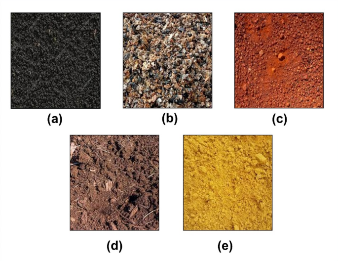
Soil type identification is a fundamental prerequisite in modern precision agriculture, civil engineering, and environmental conservation. Different soil categories—such as Clay, Sand, Loam, Silt, and Peat—possess distinct nutrient capacities, water retention levels, and structural stabilities. Traditionally, soil classification relies on physical field sampling and lab-based chemical testing, which are time-consuming, expensive, and impractical for real-time agricultural advisories in remote regions.
The Classification of Soil Images using Convolutional Neural Networks project offers an automated, non-invasive alternative powered by deep learning and computer vision. By analyzing visual soil surface characteristics—including color variations, grain texture, moisture appearance, and particle granularity—from digital images, deep Convolutional Neural Networks (CNNs) accurately classify soil samples into target agronomic categories.
For engineering and Computer Science students, constructing an automated soil classification system provides practical experience in image pre-processing, convolutional layer architecture design, transfer learning optimization, and full-stack AI model deployment.
Key Features & Benefits
System Pipeline & Operational Workflow
The application processes digital soil images through a multi-stage deep learning pipeline engineered for rapid visual feature extraction and accurate classification.
The process begins with Soil Image Acquisition & Input, where users capture or upload surface soil photographs through web dashboards or mobile camera interfaces under standard lighting conditions.
Next, during Image Pre-Processing & Data Augmentation, the raw input image undergoes noise reduction, color channel normalization, spatial resizing, and contrast stretching. Data augmentation steps like random rotation, flipping, and brightness scaling are applied to increase model generalizability across varying field conditions.
This advances to Convolutional Feature Extraction, where stacked convolution and max-pooling layers extract low-level spatial features (such as grain boundaries and color intensity variations) alongside high-level textural patterns.
Following this, Classification & Multi-Class Scoring passes the extracted feature maps into fully connected dense layers with Softmax activation, computing probability distributions across target soil types (e.g., Clay, Sandy, Clayey Loam, Silty).
The system then enters Crop & Fertilizer Recommendation Mapping, where the predicted soil class triggers a lookup query in an agronomic database to match suitable crops, optimal irrigation strategies, and target fertilizer ratios.
Finally, the system outputs Web Visualization & Diagnostic Reporting, displaying the identified soil class, prediction confidence score, textural analysis summary, and actionable agricultural advice on an interactive user interface.
Implementation Guide
Key Features & Essential Technologies
Developing an AI-driven soil classification system balances deep network inference accuracy with accessible software delivery. Key features include multi-class soil type identification, real-time image upload handling, confidence score visualization, integrated crop recommendation advisories, and responsive web interface design.
The recommended technology stack uses Python 3.10+ as the core programming environment. Deep learning framework execution relies on PyTorch, TensorFlow, Keras, or torchvision. Computer vision and image processing operations are powered by OpenCV, PIL (Pillow), and NumPy. Pre-trained architectures commonly fine-tuned for transfer learning include MobileNetV2, ResNet-50, and EfficientNet. Web deployment and API endpoints can be constructed using Python Flask, FastAPI, or Streamlit, paired with a clean HTML5/CSS3 frontend.
Technical Specifications
Step-by-Step Implementation Guide for Students
Follow this structured step-by-step roadmap to build, train, evaluate, and deploy your final-year project:
Dataset Acquisition & Pre-Processing Setup
Action: Collect or download benchmark soil datasets containing labeled images of various soil categories. Write a Python script to structure dataset directories, resize all images to uniform input dimensions (e.g., 224x224 pixels), and normalize pixel values between 0 and 1.
Verification: Run a dataset validation script to verify that class folders are balanced, file paths are intact, and image tensor shapes match model input expectations.
Model Architecture Selection & Transfer Learning
Action: Select a lightweight CNN architecture such as MobileNetV2 or ResNet-50 pre-trained on ImageNet. Replace the top classification head with custom dense layers matching your target soil classes, and unfreeze key top layers for fine-tuning.
Verification: Execute a baseline training epoch on a small image batch to verify GPU memory stability and loss reduction.
Hyperparameter Optimization & Training
Action: Train the deep network using categorical cross-entropy loss and the Adam optimizer. Apply data augmentation pipelines to prevent overfitting, tracking training and validation performance across epochs.
Verification: Plot training versus validation accuracy and loss curves to confirm model convergence and ensure test set accuracy exceeds 90%.
Web UI Development & Application Deployment
Action: Integrate the saved model weights (.h5 or .pth) into a Flask or FastAPI web backend. Build a user-friendly frontend interface featuring file upload capabilities, instant result rendering, and downloadable soil management PDF reports.
Verification: Test the complete web application by uploading diverse test soil images to confirm smooth execution, rapid inference speeds, and accurate UI rendering.
Conclusion & Next Steps
Future Scope & Industry Applications
Integrating deep learning soil classification with modern agricultural technology offers significant growth potential:
IoT & Mobile Field Sensors: Deploying quantized lightweight models onto portable smart devices and handheld spectrometers for immediate field analysis.
Drone-Based Soil Mapping: Integrating vision models into autonomous drone mapping software to assess topsoil characteristics across large farm plots.
Smart Irrigation & Precision Agriculture: Connecting soil classification backends directly to automated irrigation systems to regulate water usage according to soil drainage properties.
Building a Classification of Soil Images using Convolutional Neural Networks project arms computer science and engineering students with practical expertise in deep learning model design, computer vision processing, transfer learning, and real-world web deployment.
Contact Details
Aislyn Technologies, Bangalore
📞 Phone: +91 97395 94609
📧 Email: info@aislyntech.com
🌐 Website: https://aislyn.in
Contact us today to start building your Embedded project in Bangalore with our expert support!